
Research at Mbuluzi

Mbuluzi Game Reserve has always been open to allowing research activity on the property and many interesting and useful research projects have been conducted. To take this research further Mbuluzi now rents a portion of the property to the company All Out Africa who has set up a Savannah Research Center. The center has built up relationships with a number of universities from around the globe who use the center and game reserve for research projects.
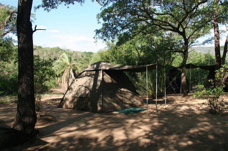
The Savanna Research Center is set on the banks of the Mbuluzi river on the northern side of the Game Reserve and is an initiative of All Out Africa with support from the University of Florida. The center caters for students, researchers, and volunteer groups. The center is comprised of:
· a thatched research building with store room, kitchenette, working stations and a common room,
· a communal braai and relax area under shady trees and gazebos
· 7 two person dome tents with beds
· 3 two person A-frame tents with beds
· two ablution units with flush toilets & hot showers
The center has a resident field ecologist with two research assistants employed by All Out Africa to co-ordinate on-going field work and organise student and volunteer groups.
About the Savannah Research Center
General
The research center is used for accommodation, meetings, lectures, presentations and workshops for field research and education purposes. The center is open to independent researchers wishing to use the center to carry out research projects. Such researchers will need to adhere to the terms & conditions of the center specifically and Mbuluzi Game Reserve in general.
The Vision of the Center:
To be globally recognised as a leader in research and education for conservation and ecology in African savannas, with a particular focus on the ecology and impacts of land use change.
The Purpose of the Center:
To engage people locally and from around the world in high quality field research and education in the Lubombo Conservancy of Swaziland and beyond.
The Goals of the Center:
· to foster ecological research, awareness and understanding among the diverse stakeholder groups in southern Africa (researchers, students, volunteers, conservation practitioners, community members and others);
· to facilitate participation in field research, information sharing and biodiversity conservation among relevant people & institutions (natural resource users from neighboring communities, Swazi society, corporations, conservation organizations, academic institutions, government and others);
· to improve biodiversity conservation efforts in north eastern Swaziland and beyond through research and information sharing;
The Objectives of the Center:
· to serve as an accommodation and equipment storage base for field staff, researchers and students;
· to foster a safe and pleasant environment to enhance the motivation, productivity and well-being of individuals and groups using the center;
· to improve the student/participant experience on All Out Africa’s programs;
· to improve the outputs from the projects implemented by All Out Africa (& it’s partners) in the Lubombo Conservancy and beyond;
· to serve as a centre that synthesizes & co-ordinates field research and data;
· to serve as a catalyst for research and education programs;
· to inspire and train Swazis to do field research.
Find out more about the Savannah Research Center
Independent researcher applications for use of the center will be made to researchcenter@alloutafrica.org.
Some of the Recent and Ongoing Research Projects
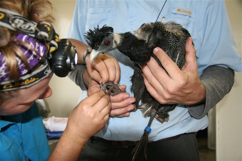
Reproductive Demographics of Crested Guinea fowl, Guttera pucherani
Project Background
Guineafowl have significant value to African communities. They are potentially an important source of hunting revenue, are prey items for carnivores, and contribute to overall biological diversity. Individual species tend to respond to habitat fragmentation in different ways. In forest-inhabiting species traits such as small population size, gregariousness, terrestrial foraging and nesting, and low annual survival and fecundity rates have been associated with a proneness to local extinction (Lawes et al. 2006). Crested guineafowl (Guttera pucherani) have been shown to exhibit these traits (Lawes et al. 2006), indicating that with continued habitat fragmentation the species may be at risk of local extinction.
The objectives of this research study are to determine important demographic information about crested guineafowl such as reproductive demographics, survival and habitat selection, to determine what characteristics comprise successful nests, and to determine the effects of agriculture operations such as sugarcane on guineafowl populations at a landscape level. Though the research will focus on crested guineafowl, in the event that insufficient numbers of crested guineafowl are available or captured, the project will switch to focus on helmeted guineafowl, Numida meleagris.
Project methods
We will be trapping, tagging and ringing crested guineafowl. Birds will be trapped using two different methods, electro-magnetic drop net, and wire walk-in funnel traps. All birds will have rings with individual numbers specific to each bird. Males and juvenile bird will be both ringed and tagged using patagial tags. The females that are trapped will be ringed, radio collared and tracked to determine winter survival. During the breeding season, from October to February, females will be tracked, and nests will be monitored daily. After the nesting season, vegetation data will be collected at nest site for analysis. All data collected will be used to answer the above objectives.
Signs of project
You might see trap sites baited with mixed fowl food, which contains corn, milo, and sunflower seeds. You may also come across a wire trap with a funnel. These traps will be checked every 3 hours to prevent unnecessary stress to the birds and will be locked open at night to prevent the capture of unwanted nocturnal animals. We will also have an electro-magnetic drop-net in various places around the reserve.
Relevance of project to MGR
With the information provided by this project MGR will get an abundance estimate of crested guineafowl as well as information about reproductive parameters that has not previously been published.
Assessment of Mammalian Biodiversity at Mbuluzi Game Reserve
Project background and brief
This project is conducted in cooperation with researchers from the University of Florida. Students will participate in conservation research. Taxonomic emphasis will be on mammals, but information will be obtained on other vertebrates, parasites, and plants. Students will have an
opportunity for hands-on learning in one of the most diverse and complex ecosystems on the planet.
Project methods
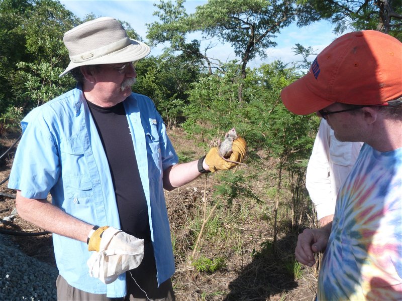
Small live traps will capture small mammals, which will be examined and released unharmed at site of capture. Mist nets will capture bats, which will be examined and released unharmed at site of capture. Game cameras will help assess presence and abundance of larger mammals; images will be downloaded and quantified. Game drives and walks will be used to estimate abundance of larger mammals. Fecal samples will be examined to assess parasite faunas.
Signs of the project out in the game reserve that someone might see
Most game cameras and small-mammal traps will be placed on already established population-assessment grids used by researchers from the University of Florida. Some small-mammal traps (marked with red flagging) and mist nets may be visible shortly before sunset, at night, or early in the morning. Except for those traps and game cameras near our campsite or on the population-assessment grids, small-mammal traps, mist nets, and flagging will be removed shortly after sunrise each day.
Relevance of project to MGR
Data on presence and relative abundance of bats, rodents, other small mammals, and large mammals will be useful to personnel at Mbuluzi Game Reserve in making well-informed management decisions.
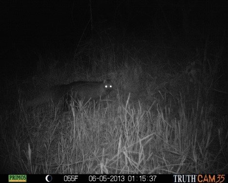
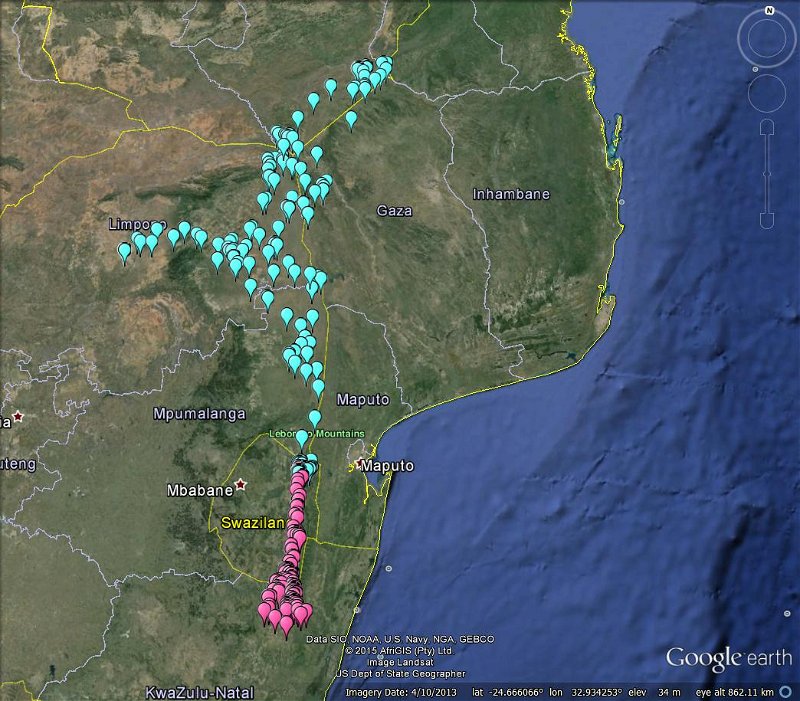
Savannah Monitoring: Camera Trapping
Project background and brief:
Our project is part of a ten-year monitoring plan with the aim of assessing biodiversity in Swaziland’s savannah ecosystems. Research is conducted in Mbuluzi Game Reserve and Mlawula Nature
Reserve. In this component of the project, we hope to capture photos that give us an idea about the species diversity of ungulates and meso-carnivores on the reserve. So far, we have captured over 10 species
Project methods:
We set out game cameras that are triggered by movement. Our project is conducted on 3 grids within Mbuluzi. On each grid we set up 18 cameras. Cameras remain out for 5 consecutive nights.
Signs of the project out in the game reserve that you might see:
Game cameras strapped to trees; flagging tape marking the areas around our cameras.
Relevance of project to MGR:
This project will help provide more information about species abundance and diversity within MGR. When coupled with the results from vegetative monitoring, data can help to guide future management decisions in MGR.
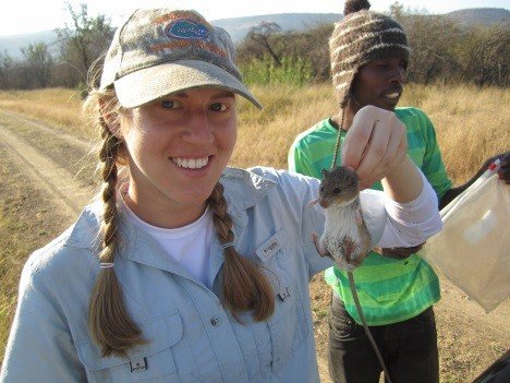
Savannah Monitoring: Small Mammal Trapping
Project background and brief:
The project is part of a ten-year monitoring plan with the aim of assessing biodiversity in Swaziland’s savannah ecosystems. Research is conducted in Mbuluzi Game Reserve and Mlawula Nature Reserve. In this component of the project, small mammals are captured, primarily rodents, in order to learn more about their species diversity and relative abundance. So far 11 species have been captured.
Project methods:
Small traps called Sherman traps are set out and baited with oats. The project is conducted on 3 grids within Mbuluzi. On each grids 144 traps are set out. The traps remain out for 4 consecutive nights.
Signs of the project out in the game reserve that you might see:
Small silver traps; bright orange flagging tape marking the areas around the traps.
Relevance of project to MGR:
This project will help provide more information about species abundance and diversity within MGR. Rodents are a very good indicator of veld condition. When coupled with results from camera trapping and vegetative monitoring, data can help to guide future management decisions in MGR.
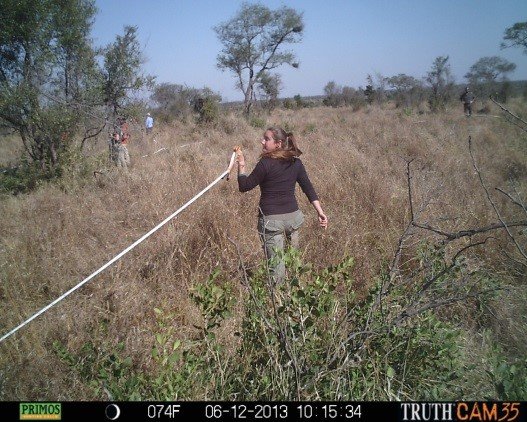
Savannah Monitoring : Vegetation Monitoring
Project background and brief:
The project is part of a ten-year monitoring plan with the aim of assessing biodiversity in Swaziland’s savannah ecosystems. Research is conducted in Mbuluzi Game Reserve and Mlawula Nature Reserve. In this component of the project, annual measurements of various components of vegetative composition and structure are taken.
Project methods:
The project is conducted on 3 grids within Mbuluzi. Each grid contains 9 plots. On each plot, surveys are conducted to measure the canopy cover, tree density, shrub cover, horizontal profile cover, grass biomass, ground cover, and the presence or absence of both indicator and alien invasive species.
Signs of the project out in the game reserve that someone might see:
Flagging tape marking the areas around the plots.
Relevance of project to MGR:
This project will help provide more information about vegetative structure and composition within MGR. This is probably the most significant aspect to the running of a game reserve.When coupled with the results of small mammal trapping and camera trapping, data can help to guide future management decisions in MGR.
Investigation of Foraging Behaviour of African White-backed Vultures (Gyps africanus)
Project background and brief
By revealing how vultures forage we can better understand how to conserve them. The foraging networks that vultures form are only effective at a certain population size for a given area. Too few individuals and the value of networking is destroyed, ultimately endangering the remaining animals. This project aims to tag a number of African White Backed vultures (Gyps africanus) from a population in Swaziland. By examining how they forage individually and collectively at a high temporal resolution our work hopes to shed light on a substantial area of vulture ecology.
Project methods
In order to gather data on the vultures we have created a ‘vulture restaurant’. The concept is simple. Supply vultures with a steady, predictable food source. The supplier knows where the carcass is coming from and can be sure that it will have no ill effects on the birds. The restaurant causes the vultures to get habituated with the site which will help in their capture. In addition to culled animals the site has a walk-in trap designed to capture the birds. The trap can capture tens of birds at a time and will allow researchers to measure, tag, recover data etc. After this short process the birds are released back into the wild.
Bats in a mosaic landscape: insect control and disease ecology in the Lowveld
Project background and brief
Changes in land-use and the loss of habitat has a profound impact on almost all species of fauna. The Lowveld of Swaziland made up of a mosaic of land-use types, including intensive sugarcane cultivation, urban and peri-urban areas, rural homesteads, and natural vegetation, much of which is in protected reserves.
Bats are the second most diverse group of mammals with over 1200 species worldwide. There are over 20 species of bats in Swaziland. It is essential to understand not only how alteration of the landscape affects the structure of bat communities, but how changes due to changes in land-use affect the relationship between bats and people.
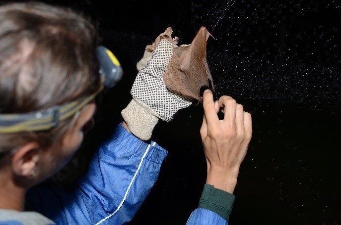
Project methods
Bats will be monitored in the northern part of the Swazi Lowveld. Maize fields in four different land-use categories (intensive agriculture, rural agriculture, urban, and natural vegetation) have been chosen. Anabat acoustic bat detectors will be placed near maize fields and the surrounding habitat within a 3 km2 block. In addition, mist-nets will be used to capture bats. Captured bats will be identified by species, weighed, and measured. Fecal and blood samples will be collected from all bats. They will then be released.
Signs of the project out in the game reserve that someone might see
You might see us trapping bats with mist nets at night. We pack them up and bring them with us when we finish. You may also see blue boxes with Anabat detectors tied in trees or on posts.
Relevance of project to MGR
Bats provide a variety of ecosystem services, such as controlling insect populations and dispersing seeds. Changes in land-use may affect the ability of bats to provide these services. In addition, some species may roost in buildings and homes, becoming a nuisance. Further, bats are a host reservoir of many zoonotic diseases, pathogens that jump from animals to people. So far, very little research has been conducted on the disease ecology of bats in Swaziland.
Habitat Selection of Wahlberg’s Epauletted Fruit Bat (Epomophorus wahlbergi) in an Agriculture/ Game Reserve Matrix
Abstract
Bats are recognized as important seed dispersers in many regions of the world however seed dispersal by bats is poorly understood in Africa (Hodgkison et al. 2003, Modadjem 2010, Seltzer et al. 2013). Understanding how an agricultural land matrix impacts fruit bat movement is an important conservation research need. This study will seek to understand what agroecosystem landscape attributes encourage fruit bat use or discourage dispersal, the distance and home range size of fruit bats, roost selection of fruit bats, and plant species dispersed by fruit bats in a landscape fragmented by agriculture. Extensive use of radiotelemetry will be used to fulfill these objectives. This research will address a member of the family Pteropodidae which comprises the Old World fruit bats.
Introduction
Comprising at least 1,115 species and occupying every continent except Antarctica, bats represent a fifth of all mammal species on Earth (Monadjem et al. 2010). Although an important component of mammalian diversity, lack of knowledge about bats has precluded wider attention from conservation groups such as the International Union for Conservation of Nature (Hodgkison et al. 2003). Basic information on the biology and ecology of most bat species is lacking including information about population demographics, roost use, and foraging areas (Fenton 2003). The longevity, mobility, and size of bats as well as the diverse trophic levels they fill may make them especially strong indicators of ecosystem health (Fenton 2003). Bats are ecologically and taxonomically diverse and occupy many trophic niches. Over 100 bat species occur in southern Africa and information on roost site selection, daily movement patterns, and home range of these African bat species are especially sparse (Monadjem et al. 2009).
Although their new world phyllostomid counterparts have received a great deal of attention (Quesada et al. 2003, Mello et al. 2011) pteropodid bats are increasingly recognized for the important ecosystem services they provide as pollinators and seed dispersers (Hodgkison et al. 2003, Nyhagen et al. 2005, Seltzer et al. 2013). About 300 plant species are known to rely on pteropodid fruit bats for these services (Duncan and Chapman 1999, Cordeiro and Howe 2001, Hodgkison et al. 2003). For example, a study in Malaysia found 13.7% of trees in a 1-ha plot were at least partially dependent on pteropodids for seed dispersal, pollination, or both (Hodgkison et al. 2003), and Seltzer et al. (2013) identified 49 bat-dispersed plant species in Tanzania including 28 species not previously known to be dispersed by bats. Bats are capable of traveling long distances (Richter and Cumming 2008) thus distributing seeds to isolated areas (Cox et al. 1991) and bat-dispersed seeds may be more likely to reach highly disturbed areas than bird-dispersed seeds as birds tend to deposit seeds under the parent tree (Muscarella and Fleming 2007). Duncan and Chapman (1999) found that seed rain from tall trees in a degraded post-agricultural setting was probably from bats and speculated that bats contribute a unique suite of species to seed rain in degraded areas. Seeds dispersed by fruit bats may display increased seedling establishment and reduced predation when deposited away from the parent tree although this activity may be dependent on pteropodid density (McConkey and Drake 2006). Bats may play important roles in seed dispersal when large animals such as elephants and primates have been removed (Vanthomme et al. 2010) especially considering that bats disperse large seeds (Seltzer et al. 2013) of potentially economically valuable tree species (Muscarella and Fleming 2007).
Wahlberg’s epauletted fruit bats have a broad distribution in sub-Saharan Africa. They feed on many plant species (Mickleburgh et al. 1992) and seem to favor wild figs (Ficus spp) (Monadjem et al. 2010). Wahlberg’s fruit bat moves from day roosts to foraging areas and feeding roosts sites and may select riparian areas (Fenton et al. 1985, Monadjem et al. 2010). Thus far most habitat studies have been based on small sample sizes. Rollinson et al. (2013) investigated Wahlberg’s epauletted fruit bat in an urban setting and Bonaccorso et al. (unpublished) studied Wahlberg’s epauletted fruit bat in the Kruger National Park. An investigation of this species in an agricultural setting will fill in our knowledge of these important seed dispersers.
Given the amount of land that has been disturbed through agricultural conversion, understanding the role of fruit bats in reestablishing forest communities is of considerable conservation concern (Fleming et al. 2009). It is possible that more African plant species are dispersed by fruit bats than is currently recognized (Seltzer et al. 2013). This study seeks to understand what agroecosystem landscape attributes encourage fruit bat use or discourage seed dispersal services, the distance and home range size of fruit bats, habitat utilization and roost selection of fruit bats, and plant species dispersed by fruit bats in a landscape fragmented by agriculture. There has been scant research attention on these important seed dispersers in agricultural settings in Africa. It is likely that agricultural pressure on natural landscapes in Africa will increase, that some areas will be poorly suited for agriculture, and there will be a need for restoration of these degraded sites. Information on the role of seed dispersers and conditions favorable to them will inform these efforts.
The primary objectives of this research are to:
• Investigate how an agricultural landscape influences habitat selection and movement of fruit bats.
• Assess whether riparian zones with trees facilitate movement through agricultural fields.
• Assess habitat utilization of fruit bats in an agriculture/reserve matrix
Secondary objectives are to:
• Determine plant species dispersed and minimum dispersal distance
• Characterize roost site selection
• Examine social behavior such as fission and fusion dynamics
Study Area
This study will be conducted in the vicinity of the Mbuluzi Game Reserve in northeastern Swaziland, Africa. The region contains the largest protected area network in Swaziland with three protected areas in close proximity: Mbuluzi Game Reserve, Mlawula Nature Reserve, and Hlane Royal National Park. These lands contribute to the 60,000 ha Lubombo Conservancy, a conglomeration of private property, Swazi nation land, and proclaimed protected areas set aside as a contiguous block to facilitate conservation efforts. The landscape is predominately Acacia savannah with areas of riparian vegetation and is fragmented by large sugarcane plantations (Noer et al. 2012). The area experiences a subtropical climate with cool dry winters and hot, wet summers (Noer et al. 2012). Southern African trees fruit throughout the year and at least one species, Ficus sycamorus, fruits aseasonally with individual trees fruiting any time of the year (Cumming and Bernard 1997, Noer et al. 2012).
This area is well suited for examining the impact of agriculture on fruit bat movement because agricultural fields bisect a large reserve system. Agricultural fields extend north to south largely separating Mbuluzi Game Reserve and Mlwula Nature Reserve from Hlane National Park. Riparian strips extend from protected areas into agricultural areas.
Methods and Materials
Johnson (1980) identified four hierarchical orders of habitat selection. First-order selection describing the geographical range for the species, second-order describing the home ranges of groups and individuals, third-order encompassing use of resources within the home range and fourth-order describing the actual food consumed by individuals. This project will examine multiple orders of fruit bat habitat selection. Regional selection of home range, foraging and roost areas within the home range, and individual food items will be examined and described. Exact methodology may change in accordance with bat response to observers and what behaviors can be reasonably assessed.
Capture and Radio Telemetry
Thirty-five bats will be captured and radio-tagged from both intact reserve areas and riparian strips within agricultural fields. Bats will be captured using mist nets (Kunz and Parsons 2009), canopy nets (Rautenbach 1985), and/or harp traps (Tidemann and Woodside 1978). Upon capture morphometric data will be recorded and sex, age, and reproductive status will be assessed. Sex and reproductive status will be assessed through examination of genitalia and lactation. Males will be examined to see if testes are distended (Kunz and Parsons 2009), female nipples will be examined to determine whether they are nulliparous, parous, or lactacting, and palpation will be used to assess pregnancy (Pearson et al. 1952). Juveniles will be identified by incomplete ossification of the epiphyses (Andersen 1917, Kunz and Parsons 2009). A position sensitive radio transmitter (Advanced Telemetry Systems, ATS, Isanti MN, USA) will be attached with a neck collar and will be further secured between the scapulae on the dorsal surface using medical glue (Carter et al. 2009). Transmitters will not exceed 5% of bat mass based on results of (Aldridge and Brigham 1988).
Radio tagged bats will be tracked from May 2014 to December 2014 using a radio receiver (Lotek Wireless Inc., Newmarket, Ontario, Canada) and Yagi antennae (AF Antronics Inc., Urbana, USA). When necessary a pair of people will work in tandem to obtain triangulated positions. Locations where a radio fix is obtained will be recorded using a Global Positioning System (GPS) as well as bearing to strongest signal and gain setting. Calibration of distance and gain setting will be measured with day roosting bats. If an observer works alone, locations will be obtained by homing in on the signal (White and Garrot 1990) and marking the location with the GPS unit. When possible a visual confirmation of bat location will be made. If a bat stops to feed or roost the observer will home in on the location and record these location data. A minimum of 30 location fixes will be obtained for each individual bat to prevent inaccurate calculation of home range (Seaman et al. 1999) although a minimum of 50 locations will be preferred.
Two general techniques will be utilized. Three nights a week individual bats will be followed from dusk until dawn recording locations every ten minutes. Other nights a larger number of individual bats will be located and location data recorded. This will allow an assessment of both broad scale space use and fine scale movement. Fine scale data will aid in understanding utilization distribution or amount of time spent in a geographical space.
Bat activity will be recorded as commuting (continuous flight >10 minutes), foraging (flight <10 minutes), or roosting (no movement for ≥ 10 minutes). These activity data will help clarify how bats are utilizing a given habitat type.
Weather data will be taken 3 times a night at shortly after dusk, middle of the night, and prior to dawn. These weather data will help inform when the season has changed for analysis of the impact of season on bat behavior. When possible reproductive status of radio tagged bats will be noted.
Mapping
Locations will be mapped using ArcGIS (Environmental Systems Research Institute, Redlands, CA). These data may be used to create minimum convex polygons to estimate home range of individual bats using fixed kernel density estimates (White and Garrott 1990). Different model selection will be dependent on sample size and bat activity. If agricultural fields mark a sharp boundary to bat use a local convex hull non-parametric method may be used to provide a better picture of bat home range and utilization distribution (Getz et al. 2007). If closely spaced and precise location data can be obtained without impacting bats, a Brownian bridges model may provide a clear picture of bat use in narrow riparian bands traversing agricultural fields (Fischer et al. 2013). Habitat use will be compared against total amount of habitat type available (Thomas and Taylor 2006). Model selection will be decided upon assessment of initial data collection. A model will be chosen based on its ability to answer the research questions rather than the research questions being guided by model selection (Fieberg and Börger 2012).
3.3 Roost Site Measurements and Diet Analysis
Day, night, and feeding roosts sites will be identified via radio telemetry. Roost and feeding sites will be visited during daylight hours to record tree species, record environmental characteristics, and locate spat out fruit remnants known as bat wadges. Height and diameter of roost trees will be measured using a clinometer, measuring tape, and DBH tape.
Bat wadge and fecal samples will be collected under feeding roosts with 1 m2 sections of nylon mesh mounted on four 0.5 m long stakes. Fecal and wadge seeds will be collected from these seed rain traps on a regular schedule. Seeds will be isolated and identified to species (Kunz and Parsons 2009). Any evidence of folivory will also be collected and recorded. Distance to nearest adult tree of collected seed species will be located to establish minimum seed dispersal distance (Seltzer et al. 2013).
Statistical Analysis
Statistics for estimating home range size and habitat use will be dependent on data properties (i.e. equal or unequal number of location fixes per individual) and sample size as well as the response of bats to observers. Individual bats will be the sample unit for data analysis. A chi-square goodness of fit analysis may be used to understand resource use against availability (Neu et al. 1974). Multivariate methods may be used to understand the impact of various landscape features such as width of the riparian zone, distance to contiguous forest edge, and distance to roads. Polytomous or multinomial logistic regression may be appropriate to assess resource selection (North and Reynolds 1996) depending on the precision of the data collected. A species rarefaction curve (Gotelli and Colwell 2001) will be used to assess samples from seed rain traps and to provide an estimate of total plant species dispersed by bats in the landscape.
Share This Page